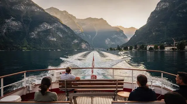
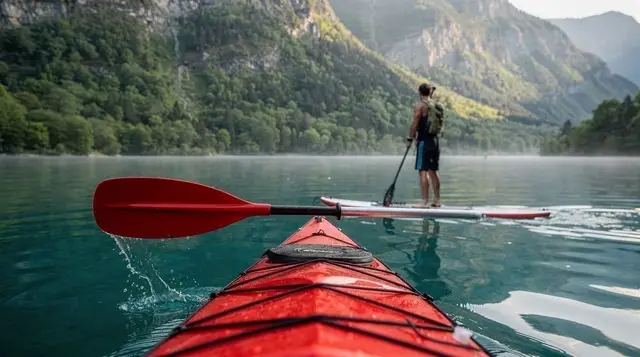
Interlaken sits on a narrow strip of land — the Bödeli — squeezed between Lake Thun and Lake Brienz, and that geography is the whole story of the place. It isn’t really a mountain town; it’s the flat, green hinge between two lakes and the valleys that lead up to them, and almost everything about how it’s laid out follows from that.
The strip between the lakes
The town proper has around 5,900 residents, closer to 15,000 once you include Unterseen and Matten, the two neighbouring communities that blur into it without any real border. All three sit in the canton of Bern, all three are German-speaking, and all three are at 568 m, low enough that snow is rare in the town itself even when the peaks around it are white. Lake Thun lies to the west, Lake Brienz to the east, and the Aare river connects them, cutting straight through the middle of Interlaken on its way from one lake to the other.
Because of that layout, Interlaken functions less as a sightseeing destination and more as an interchange — trains, boats and cable cars radiate out from here to Lauterbrunnen, Grindelwald, the Jungfraujoch and both lakes. Spend a morning walking the town and you’ll have seen most of what it offers directly; the rest is a short train or boat ride away.
The Höhematte and the Höheweg
The Höhematte is a 14-hectare meadow protected from development right in the centre of town, and it’s the single most useful thing to understand about Interlaken’s layout. Grand hotels line its edges rather than facing the lake or the mountains directly, because when they were built in the 19th century, an open view of the Jungfrau across a green field was the selling point. That’s still true: on a clear day you get a genuine, unobstructed view of the Jungfrau summit from the meadow, with the Mönch visible from some angles further along. The Eiger’s famous north face, though, stays hidden behind closer ridges until you’re deeper into the valley — a detail worth knowing so you’re not disappointed hunting for it from town.
The Höhematte is also Interlaken’s paragliding landing strip. Pilots launch from Beatenberg, the Schynige Platte area and other points above town, and land in the meadow throughout the day in good weather — it’s a genuinely reliable free spectacle from spring through autumn, and one of the better reasons Interlaken has built a reputation as an outdoor sports base rather than just a scenic stopover. Entry to the meadow itself costs nothing.
The Höheweg is the promenade bordering the Höhematte, running roughly between the two train stations. It’s where the grand 19th-century hotels sit — the Victoria-Jungfrau chief among them — alongside shops, tour operator kiosks and restaurants aimed squarely at visitors. It’s pleasant to walk but not cheap to eat on; a coffee here runs noticeably more than a side street two minutes away.
Two stations, easy to confuse
Interlaken has two main railway stations, and mixing them up is the single most common way visitors waste time here.
| Station | What leaves from it | Nearest to |
|---|---|---|
| Interlaken Ost | Trains to Lauterbrunnen, Grindelwald and the Jungfrau region; Lake Brienz boats; the Brünig line towards Lucerne | Eastern edge of town, Harder Kulm funicular base |
| Interlaken West | Local trains, some regional connections; Lake Thun boats | Town centre, Höheweg, most hotels |
If you’re heading up towards the Jungfraujoch, Wengen or Grindelwald, you want Interlaken Ost — that’s also where the funicular up to Harder Kulm starts, an 8-minute ride to a viewpoint directly above town. If you’re catching a boat across Lake Thun towards Spiez or Thun, that’s Interlaken West. The two stations are about a 20-minute walk apart along the Höheweg, or a few minutes by local bus — manageable if you catch the mix-up early, less so if you’re already on the wrong platform with a train pulling in.
The Kursaal and the casino
At the western end of the Höhematte sits the Kursaal, Interlaken’s casino and events centre, with gaming tables, a cinema and a garden used for events and markets through the year. It’s not a major attraction in itself — treat it as an evening option rather than a reason to visit — but its garden and terrace are a reasonable spot for a drink with a Höhematte view without the mark-up of the grand hotel terraces further along the Höheweg.
Along the Aare
The Aare river runs through the middle of Interlaken between the two lakes, and a walk along its banks is one of the better free things to do in town. The water carries the same striking turquoise-grey colour you see at Lake Brienz — glacial rock flour suspended in the water — and the riverside path connecting Unterseen to the rest of Interlaken is flat, shaded in places, and largely ignored by visitors who stick to the Höheweg. Unterseen itself, just across the river, has an older, quieter centre with a 13th-century church tower and none of the tour-kiosk density of central Interlaken — worth the ten-minute walk if you want a sense of what the area looked like before tourism arrived.
What you actually see without leaving town
It’s worth being honest about this, because it shapes how much time to budget in Interlaken itself versus getting up into the mountains:
- The Jungfrau summit — visible from the Höhematte and parts of the Höheweg on a clear day, unobstructed.
- The Mönch — visible from some angles, partially screened from others.
- The Eiger — not visible from town; its famous north face is blocked by closer terrain and only opens up as you travel towards Lauterbrunnen or Grindelwald.
- Lake Thun and Lake Brienz — not visible from the town centre itself; you need to walk or ride to the shoreline, or up to a viewpoint like Harder Kulm, to see either lake properly.
- A genuine panorama of the Bödeli, both lakes and the peaks together — this needs elevation. Harder Kulm, reached by funicular from Interlaken Ost in 8 minutes, is the fastest way to get it.
In short: the town gives you one good mountain view and two lakes you have to walk to reach. Everything else — the classic “town between two lakes with mountains behind” photograph — needs you to go up.
Getting up close: what requires leaving the valley floor
Interlaken’s job is to hand you off to the things around it, and the region’s actual highlights sit well outside town:
- Jungfraujoch (3,454 m) — Europe’s highest railway station, reached via Lauterbrunnen and Kleine Scheidegg, or via Grindelwald and the Eiger Express. A full-day undertaking and the region’s signature excursion, at a price to match — see the Jungfraujoch guide before committing.
- Schilthorn (2,970 m) — the revolving restaurant at Piz Gloria, reached via Mürren, a car-free village.
- Harder Kulm (1,322 m) — the closest viewpoint to town, and the only one you can reasonably do as a half-day add-on.
- Lake Thun and Lake Brienz — both served by scheduled boats from Interlaken West and Ost respectively; see the two-lake cruise guide for how to combine them.
None of these are things you can improvise well without checking the season first: Bernese Oberland lifts close for maintenance in spring and autumn, and several close on high-wind days regardless of season — check the current status before building a day around any single summit.
Where to base yourself: Interlaken, Unterseen or Matten
All three sit close enough together that the choice is more about atmosphere and price than convenience.
| Base | Character | Trade-off |
|---|---|---|
| Interlaken (centre) | Most hotels, both stations, Höheweg shops and restaurants | Busiest, priciest for equivalent rooms |
| Unterseen | Quieter, older centre, riverside | 10–15 minute walk to either station |
| Matten | Residential, closer to Wilderswil and Harder Kulm’s eastern approach | Fewer restaurants within walking distance |
For a single night before or after a mountain excursion, staying near Interlaken Ost saves the most hassle. For a longer stay, Unterseen is worth the short extra walk for a quieter base at a similar or slightly lower price.
Practical notes
Currency is the Swiss franc (CHF); cards are widely accepted but small cafés and market stalls sometimes prefer cash. Switzerland is in the Schengen area but not the EU, so visa-exempt nationalities still need to check ETIAS requirements before travelling. Sockets are type J at 230 V. Tap water is safe and good enough that bottled water is rarely worth buying. Service is included in restaurant prices; rounding up is normal, a large additional tip is not expected. For any emergency, dial 112; for mountain rescue specifically, REGA operates on 1414.
Getting around the Bödeli itself rarely requires transport beyond your own feet — most hotels, both stations and the Höhematte sit within a 20–25 minute walk of each other. For everything beyond town, the Swiss Travel Pass or the regional Jungfrau Travel Pass are worth pricing against your planned excursions before buying individual tickets.
Doing more from town
A handful of trips run directly from Interlaken and use the town itself as the starting point rather than just a station to pass through. An e-bike loop taking in both lakeshores and the ruins above Unterseen is a reasonable way to see more of the Bödeli than the Höheweg allows in a few hours.
For the water itself, a Lake Thun cruise combined with the St. Beatus Caves covers ground that’s awkward to string together with public transport alone in a single afternoon. And for something more sociable after a day of sightseeing, a rafting trip on the Lütschine finished with raclette pairs an adventure activity with the kind of meal that’s genuinely better shared.
Frequently asked questions about Interlaken town
Is Interlaken town itself worth visiting, or just a base?
It’s mostly a base. The Höhematte, the Höheweg and a stroll along the Aare take a couple of hours. Most travellers spend one night in town and several days using it as a launchpad for Jungfraujoch, Schilthorn, Grindelwald and the lakes.
Which train station should I use, Interlaken Ost or Interlaken West?
Interlaken Ost is for anything heading towards the Jungfrau region (Lauterbrunnen, Grindelwald, Wengen), Lake Brienz boats and the line to Lucerne via Brünig. Interlaken West is closer to the town centre and Höheweg, and is where Lake Thun boats depart. Getting on at the wrong one can mean a 15–20 minute walk or tram ride to fix it.
Can you actually see the Eiger, Mönch and Jungfrau from Interlaken?
You can see the Jungfrau and, from some angles, the Mönch, from the Höhematte and the Höheweg on a clear day — but the Eiger’s north face is hidden behind the Harder and other ridges until you’re further into the valley towards Grindelwald or Lauterbrunnen.
Is the Höhematte free to visit?
Yes. It’s a protected public meadow with no entry charge, used for walking, picnics and as the landing zone for paragliders coming down from Beatenberg and the Schynige Platte area.
How many days do you need in Interlaken town itself?
One day covers the Höhematte, Höheweg, Kursaal area and the Aare quays on foot. Budget more only if you’re adding a paragliding flight or a lake cruise from Interlaken West or Ost on the same trip.
Is Interlaken expensive?
Yes, by most standards — this is Switzerland. A simple restaurant meal runs CHF 25–35, a coffee CHF 4–5, and a private room in a mid-range hotel CHF 150–250 a night in summer. Mountain excursions from Interlaken (Jungfraujoch return, for example) can exceed CHF 200 per person.
Should I stay in Interlaken, Unterseen or Matten?
All three sit within the same 20-minute walk of each other on the Bödeli. Interlaken has the most hotels and both stations; Unterseen, across the Aare, is quieter and slightly cheaper with an older centre; Matten, towards Wilderswil, is closer to Harder Kulm’s funicular base on the other side.
Is Interlaken safe and easy to walk around?
It’s a small, flat, low-crime Swiss town. The centre between the two stations is entirely walkable in 20–25 minutes, and street lighting and signage are good after dark.