The best day hikes from Interlaken, ranked by difficulty
Which day hike from Interlaken should I choose?
For under three hours with no lift needed, take the Giessbach shore path or the Lauterbrunnen valley floor. For a half-day with a cable car and moderate fitness, Bachalpsee or the Mannlichen to Kleine Scheidegg ridge deliver the best views for the effort. The Hardergrat is a full-day, 1,700 m ridge walk for experienced hikers only.
Interlaken sits in a bowl between two lakes with high mountains on every side, which means the hiking here runs from a flat, pram-friendly lakeshore path to a ridge walk that experienced Alpine club members treat with respect. The ten hikes below are ranked by what actually makes a trail hard: metres of ascent, exposure, how far you are from help, and whether bad weather turns a pleasant walk into a genuine problem. Distances and lift prices are approximate and change from year to year, so check current fares and opening dates before you commit a day to any of them.
How the ten hikes compare
| Hike | Duration | Elevation gain | Lift or train needed | Best season |
|---|---|---|---|---|
| Giessbach shore path | 1.5–2 h | under 100 m | Boat (optional) | April–October |
| Lauterbrunnen valley floor | 2–3 h | under 50 m | None | Year-round |
| Aare Gorge and Reichenbach Falls | 1.5 h | under 100 m | None | May–October (gorge closed in winter) |
| Oeschinensee loop | 3 h | 250–400 m | Kandersteg gondola | June–October |
| Harder Kulm circuit | 2–2.5 h | 150 m on foot (funicular does the rest) | Funicular | April–November |
| Mannlichen to Kleine Scheidegg | 1.5–2 h | 200 m descent | Cable car up | June–October |
| Bachalpsee | 2.5–3 h return | 450 m | Grindelwald First cable car | June–October |
| Faulhorn and Bussalp loop | 6–7 h | 700 m | Schynige Platte train | Late June–September |
| Eiger Trail | 3–3.5 h | 350 m (mostly descent) | Jungfraujoch railway to Eigergletscher | July–September |
| Hardergrat ridge | 8–10 h | 1,700 m | None (Harder Kulm funicular optional for the start) | July–September |
1. Giessbach shore path (easiest)
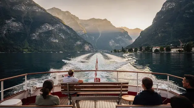
The path along the Lake Brienz shore between Iseltwald and the Giessbach Falls is as gentle as hiking gets here: mostly flat, well surfaced, and shaded by beech and chestnut trees for much of its length. Reaching the trailhead itself needs no cable car — the boat or the road gets you to Giessbach, and from there the path threads along the water past small coves. The reward is close-up views of the multi-tier Giessbach Falls, which drop through wooded terraces beside the historic funicular. It works for pushchairs on the smoother sections and for anyone recovering from a bigger day the day before.
2. Lauterbrunnen valley floor
Walking the valley floor between Lauterbrunnen village and Stechelberg is flat, well signposted, and takes you past most of the 72 waterfalls the valley is known for, including a close view of the Staubbachfall from below and the option to detour into the Trümmelbach Falls, ten glacial cascades carved into the rock (entry around CHF 14, worth timing for a sunny afternoon when the meltwater is highest). The full valley waterfall walk takes two to three hours at an easy pace with negligible elevation change, and either end connects back to the train.
A private day trip to the Lauterbrunnen waterfalls is worth considering if you would rather have a driver handle the logistics and a guide point out which cascades are worth the stop.
3. Aare Gorge and Reichenbach Falls walk
Near Meiringen, a boardwalk threads through the narrow limestone Aare Gorge, where the river has cut a slot barely a few metres wide in places. It’s a short, flat walk (entry around CHF 8) that takes under an hour if you don’t linger, extendable to 1.5 hours with a stop at the nearby Reichenbach Falls, of Sherlock Holmes fame, reached by its own funicular. The gorge closes for winter and after heavy rain raises water levels, so check it’s open before the trip out from Interlaken Ost (about 20 minutes by train).
4. Oeschinensee loop
From Kandersteg, a gondola (return around CHF 32) lifts you most of the way to Oeschinensee, an intensely turquoise glacial lake ringed by cliffs and hanging glaciers. The loop around the lake adds 250–400 m of gentle ascent and descent depending on which side path you take, and takes about three hours including a stop at one of the lakeside restaurants. Kandersteg is roughly an hour from Interlaken by train via Spiez, which makes this a longer day out than the others on this list, but the setting is genuinely different from anything closer to town.
5. Harder Kulm circuit
The funicular from Interlaken Ost to Harder Kulm takes eight minutes and does the bulk of the climbing (return fare around CHF 36, or covered by the Swiss Travel Pass), leaving a short circuit around the summit ridge and viewing platform with about 150 m of walking-level ascent and descent. What makes Harder Kulm worth the trip over other viewpoints is the angle: you look straight down the Bodeli between Lake Thun and Lake Brienz, with Interlaken laid out below like a map. It’s the easiest way to get a proper summit panorama from town within half a day.
6. Mannlichen to Kleine Scheidegg
Take the cable car up to Mannlichen (from Grindelwald or Wengen, around CHF 62 return) and walk the ridge trail to Kleine Scheidegg, a gently descending path with almost no technical difficulty and, on a clear day, the closest sustained views of the Eiger, Mönch and Jungfrau you’ll get without paying for the Jungfraujoch train. It takes 1.5–2 hours at an easy pace, with a restaurant at Kleine Scheidegg and a train back down at the end. This is the hike people mean when they say Interlaken’s mountain scenery photographs better than it climbs.
7. Bachalpsee
The walk up to Bachalpsee starts from the top of the Grindelwald First cable car (return fare around CHF 74, discounted with the regional passes) and climbs roughly 450 m over well-built trail to a pair of glacial lakes that mirror the surrounding peaks on a still morning. Budget 2.5–3 hours return at a comfortable pace, more if you want to sit by the water. It gets busy by mid-morning in summer, so an early cable car up is worth the alarm.
The Grindelwald First cable car ticket is the one to book ahead in July and August, since queues at the base station can run past 45 minutes without a timed slot.
8. Faulhorn and Bussalp loop
Starting from the cogwheel train up to Schynige Platte (return fare around CHF 63 standard, roughly half with Half Fare), the route to the Faulhorn follows a high, largely treeless ridge with wide views over both lakes and the Bernese Alps, passing near Bachalpsee before descending to Bussalp and a bus back to Grindelwald.
It’s a serious day: 700 m of ascent, six to seven hours including stops, and long stretches with no shelter from wind or sudden weather. The Faulhorn hut serves food at the high point, which is the only real refuge on the route. Do this one only in settled weather and only in late June through September, once the trail is fully clear of snow.
9. Eiger Trail
The Jungfraujoch railway takes you up to Eigergletscher, and from there the Eiger Trail runs beneath the north face of the Eiger to Alpiglen, mostly descending (about 350 m net loss) over three to 3.5 hours. The difficulty here isn’t elevation, it’s the ground: loose scree, occasional rockfall from above, and a genuine sense of scale standing under 1,800 vertical metres of limestone and ice. It’s graded moderate on Swiss trail standards but demands sure footing and no fear of exposed sections close to the base of the face. Go only between July and September, after the higher snow has cleared, and check conditions at Eigergletscher station before setting off.
10. Hardergrat ridge (hardest)
The Hardergrat runs the full ridge from above Interlaken to the Augstmatthorn, gaining around 1,700 m over eight to ten hours, with several hands-on-rock scrambling sections and long stretches of genuine exposure on both sides of a narrow crest. There’s no hut, no reliable water source once you’re on the ridge, and no easy bail-out route for much of the middle section — if the weather turns, you commit to finishing or backtracking a long way. This is a fit, experienced hiker’s route only, done in dry conditions from July to September, ideally with someone who has walked it before or with a detailed map and a very early start.
Making the choice
If you only have time for one hike, match it to your fitness and the weather forecast rather than the photos. Cloud on the high ridges (Faulhorn, Hardergrat, Eiger Trail) can turn a good day bad fast, whereas the valley-floor walks and Giessbach stay pleasant in overcast conditions. For a broader look at what else fills a longer stay, the six-day hiking itinerary strings several of these together with rest days built in, and how many days in Interlaken covers how hiking fits alongside the region’s trains and lakes.
If you’d rather not plan the logistics yourself, a guided hike to an alpine lake with a mountain hut lunch takes care of the route-finding and timing, which is useful on a first visit when you don’t yet know which lift queues to avoid. For something longer, a guided four-day Via Alpina trek links several valleys on foot with overnight stops arranged for you.
Whichever you pick, check how the lifts and trains that access these trails work before you go — cable cars and funiculars explained covers booking and timing, and it’s worth knowing that lifts here close for scheduled maintenance in spring and autumn and sometimes for wind on exposed sections, which has ruined more Interlaken hiking days than bad forecasts ever have.
Questions about choosing a day hike from Interlaken
Do I need to book cable cars in advance for these hikes?
For Grindelwald First, Mannlichen and Kandersteg-Oeschinensee, booking a time slot online a day ahead avoids queueing in July and August. Harder Kulm and Schynige Platte rarely need advance booking outside peak weekends.
Which of these hikes is possible without a cable car or train?
The Giessbach shore path and the Lauterbrunnen valley floor walk both start and end at a train station on the valley floor and need no lift. The Aare Gorge walk from Meiringen is also reachable on foot from the station.
What is the best month for high-altitude hikes like the Faulhorn or Bachalpsee?
Mid-June to early October, once the snow has cleared from the passes. Late June still carries snow patches on north-facing sections in most years, and the first snow can arrive by mid-October.
Is the Hardergrat ridge really for experienced hikers only?
Yes. It has around 1,700 m of ascent, several exposed, hands-on-rock sections, and no hut or water source on the ridge itself. It is not signed as a via ferrata but demands a similar head for exposure.
Can I use the Swiss Travel Pass or a regional pass for the access lifts?
The Swiss Travel Pass covers Harder Kulm and the Schynige Platte train fully. The Jungfrau Travel Pass and Berner Oberland Pass give discounts or free rides on Grindelwald First, Mannlichen and several others; check each pass’s validity map before you go.
What should I pack for a day hike above 2,000 metres?
Layers, a windproof shell, sun protection even in cloud, sturdy shoes with grip, at least a litre of water, and cash or card for hut food. Weather on the Bernese Oberland ridges changes faster than the forecast suggests.
Are these trails suitable for children?
The Giessbach path, the Lauterbrunnen valley floor and the Harder Kulm circuit work well for families. Bachalpsee and Mannlichen to Kleine Scheidegg suit older children used to walking for two to three hours. Leave the Eiger Trail and the Hardergrat for adults.
Lake cruises & boat tours on GetYourGuide
Verified deep-linked GetYourGuide tours. Book through these links and we earn a small commission at no cost to you.
GetYourGuide does not provide a product photo for this activity — the image shows the meeting point, photographed by us.