The Männlichen to Kleine Scheidegg trail
How long is the Männlichen to Kleine Scheidegg trail and is it easy?
It is 4.5 kilometres one way, takes about 1 hour 15 minutes at an easy pace, and loses roughly 170 metres in altitude with almost no climbing. The gravel path is wide and firm enough for an all-terrain pushchair, and Kleine Scheidegg has a direct train back down.
Why this is the easiest way to see the Eiger up close
Most of the famous views of the Eiger, Mönch and Jungfrau involve a steep climb, a narrow ledge, or both. The trail from Männlichen to Kleine Scheidegg is the exception. It runs along a broad ridge at around 2,200 metres, loses height gently rather than dropping, and never asks for more than a wide gravel path underfoot. You start already high, thanks to the cable car, and spend the whole walk facing three of the most recognisable mountains in the Alps without needing hiking boots or a head for heights.
It is one of the few genuinely flat mountain walks in the Jungfrau region, which is why it turns up on so many “easiest Alpine hike” lists. That reputation is deserved, but it comes with caveats worth knowing before you commit a morning to it: the cable cars that get you there and away close in wind, the season is shorter than you’d assume, and the path can turn to soup after heavy rain despite its gentle gradient. None of that changes the basic verdict — for a low-effort, high-reward walk with a train waiting at the far end, this is close to the best option in the Bernese Oberland.
The route in numbers
| Start | Männlichen (2,229 m) |
| Finish | Kleine Scheidegg (2,061 m) |
| Distance | 4.5 km one way |
| Walking time | About 1 h 15, unhurried |
| Net elevation change | Around 170 m descent |
| Surface | Compacted gravel, wide throughout |
| Steps or ladders | None |
| Pushchair suitable | Yes, all-terrain or three-wheeled recommended |
| Shade | Almost none |
| Season | Roughly early June to late October, snow-dependent |
The path is signposted the whole way as a standard yellow-diamond Swiss hiking route, rated the easiest category (no red or blue markings involved). You cannot meaningfully get lost: it is one ridge, one direction, with Kleine Scheidegg visible for much of the walk once you’re past the first bend.
Getting to the start point
Männlichen has no road access, so the walk always begins with a lift. There are two approaches, and which one makes sense depends on where you’re coming from.
From Wengen, the Männlichenbahn cable car climbs directly from the village in about 15 minutes. Wengen itself is reached by the Wengernalp Railway from Lauterbrunnen, which in turn connects to Interlaken Ost. Since Wengen is car-free, this route suits anyone starting the day from Interlaken without a car.
From Grindelwald, the gondola runs from Grindelwald Terminal, next to the main train station, and takes about 20 minutes with a mid-station change. This is the more convenient option if you’re already based in or passing through Grindelwald, and it’s the same terminal used by the Eiger Express toward the Jungfraujoch, so it’s easy to combine both in one day.
Both cable cars run roughly every few minutes in high season, less frequently at the edges of the operating months. Fares are typically somewhere around CHF 30 one way from either direction with a full-fare ticket; the Half Fare Card cuts that roughly in half, and both routes are included with the Jungfrau Travel Pass. Buy the ticket to Männlichen only if you plan to walk down — a return ticket to the same station makes no sense once you’ve decided to finish at Kleine Scheidegg instead.
What you’ll actually see
The view opens immediately at the top of the cable car and doesn’t really let up. Standing at the Männlichen viewing platform, the Eiger’s north face is directly ahead, with the Mönch and Jungfrau completing the line of three summits to its right. The Lauterbrunnen valley falls away steeply to the left of the ridge as you walk; Grindelwald and its side valley sit to the right, lower and greener.
There’s a small detour worth taking before you start walking: the short climb to the Männlichen summit viewpoint itself, a few minutes above the cable car station, gives a wider panorama that includes the Wetterhorn and, on a clear day, back toward the Schilthorn on the opposite side of the valley. It adds maybe 15 minutes round trip and is worth it if the visibility is good.
Once on the main trail, the path undulates gently but trends downhill, curving along the contour of the ridge rather than dropping straight off it. Cattle graze the slopes in summer, and you’ll likely hear cowbells before you see the animals. There’s a small refreshment hut roughly at the midpoint in season — not guaranteed to be open, so don’t rely on it for water. The final stretch descends more noticeably into the bowl where Kleine Scheidegg sits, with the historic railway station and the Eiger’s face now looming much closer than it did at the start.
Is it really pushchair-friendly?
Within reason, yes, and this is the detail that gets this trail recommended for families more than almost any other high-altitude route in the region. The surface is compacted gravel the entire way, wide enough for two people to pass comfortably, with no steps, ladders, or scrambling sections. An all-terrain pushchair with decent-sized wheels handles it without drama on a dry day.
A few honest caveats. A standard umbrella-style city pushchair will work but will jolt more than is comfortable over the looser gravel patches, particularly in the first kilometre out of Männlichen. After rain, sections of the path get muddy and rutted, and pushing anything with small wheels becomes a genuine effort rather than a stroll.
There’s no pram-specific infrastructure — no ramps, no rest areas built for changing a nappy — so treat it as a mountain trail that happens to be flat, not a paved promenade. For more on which routes and lifts in the region actually work with a buggy, see our guide to mountain trips with a pushchair, and for a broader sense of what else suits children in the area, Interlaken with kids covers the wider picture.
Timing the walk
Budget 1 hour 15 minutes of actual walking for most adults at a relaxed pace, with photo stops. Families with young children, or anyone stopping frequently for the view, should allow closer to 1 hour 45. Add the optional Männlichen summit detour and you’re looking at roughly 2 hours door to door, cable car to cable car.
The trail faces roughly south-east to south, which matters for two reasons. Morning light on the north faces of the Eiger, Mönch and Jungfrau is generally flatter and more even than the harsh midday sun, so an early start produces better photographs. It also means the path can be busy from mid-morning onward, since it’s a popular add-on to a Jungfraujoch trip and most visitors travel up on similar schedules. Starting before 10:00 avoids the worst of the crowding on the narrower stretches near either end.
Getting away from Kleine Scheidegg
This is the trail’s other strong point: you finish at a railway station, not back where you started. Kleine Scheidegg sits on the Wengernalp Railway, with regular departures both down toward Wengen and Lauterbrunnen, and separately toward Grindelwald. Trains run roughly every 30 minutes in season. If your outbound ticket was bought only as far as Männlichen, you’ll need a fresh ticket onward from Kleine Scheidegg — factor that into the day’s cost.
If you have the time and the ticket allows it, Kleine Scheidegg is also the junction for trains continuing up to the Jungfraujoch, 3,454 metres and the highest railway station in Europe. Combining the two makes for a long day: cable car up, walk across, then a further hour or so up to the Jungfraujoch and back down. It’s a reasonable plan if the weather forecast is genuinely clear at altitude — the Jungfraujoch is a waste of money in cloud — but treat the walk and the Jungfraujoch trip as separate decisions rather than assuming you’ll have appetite for both.
When to skip it
The cable cars up to Männlichen, like most lifts in the region, close for scheduled maintenance in spring and again in autumn, and shut for the day in strong wind regardless of season. Check the current status before you travel out to Wengen or Grindelwald Terminal specifically for this walk — arriving to find the lift closed wastes half a morning. See when mountain railways open and close for the general pattern across the region.
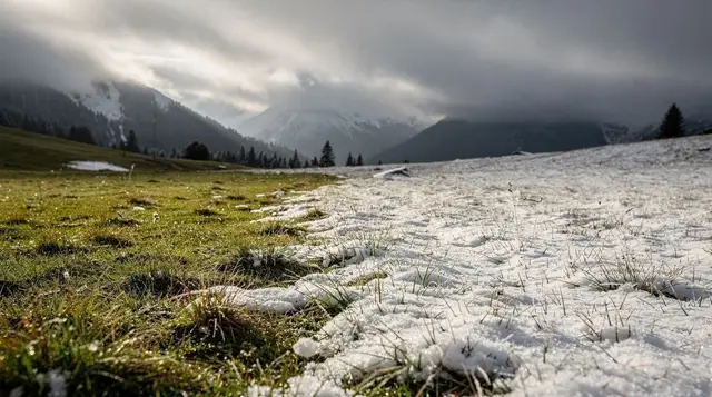
Snow can sit on the higher stretches of the ridge into early June in a late spring, and the first snowfall of autumn — sometimes as early as late September at this altitude — closes the route for the season. Outside the roughly June-to-October window, don’t plan around this trail being open; check directly with the lift operator rather than assuming.
Fog is the other spoiler. The entire appeal of this walk is the view; in cloud, you’re paying for a cable car ride to walk along a grey ridge with nothing to look at. If Interlaken is clear but the peaks are capped, it’s worth checking a webcam at Männlichen or Kleine Scheidegg before committing, and having a lower-altitude plan ready — see Interlaken in bad weather for alternatives.
How it compares to other easy trails nearby
| Trail | Distance | Difficulty | Main view |
|---|---|---|---|
| Männlichen–Kleine Scheidegg | 4.5 km | Easy, mostly flat | Eiger, Mönch, Jungfrau face-on |
| Bachalpsee hike | 6.5 km return from Grindelwald First | Easy-moderate, some climbing | Alpine lake, Wetterhorn reflection |
| Eiger Trail | 6 km one way | Moderate, rockier underfoot | Eiger north face, much closer |
| Mannlichen to Kleine Scheidegg vs Grindelwald First | — | — | See First vs Männlichen vs Kleine Scheidegg |
If the goal is specifically the flattest, least technical walk with a mountain backdrop, this route wins that comparison outright. If you want to get physically closer to the Eiger’s face and don’t mind narrower, looser ground, the Eiger Trail is the better choice. For a fuller rundown of easy options across the region, best day hikes from Interlaken puts this trail in context alongside routes that need more effort.
Practical checklist
- Wear proper walking shoes even though the path is flat — loose gravel and occasional mud make trainers a poor choice.
- Bring water; the midpoint refreshment hut isn’t guaranteed to be open.
- Check the lift status for Männlichen before travelling out, especially on a windy forecast.
- Buy tickets separately for the cable car up and the train down from Kleine Scheidegg unless you’re on a pass that covers both.
- Start before mid-morning for better light and thinner crowds on the narrower sections.
- Pack a layer — the ridge is exposed and noticeably cooler and windier than the valley floor, even in summer.
For getting the wider transport picture right before you go, the Swiss Travel Pass guide and the Jungfrau and Berner Oberland Pass guide both cover whether either pass is worth buying for a trip built mainly around this kind of excursion. If you’re building this into a longer stay, our three-day Jungfrau region highlights itinerary slots this walk in alongside the region’s other big-ticket outings.
Combining it with a guided day trip
If you’d rather not manage the cable car and train logistics yourself, several guided day trips route through this area and take care of tickets and timing. A small-group day trip through Kleine Scheidegg and Lauterbrunnen covers this stretch alongside the surrounding valleys in a single organised outing.
Coming from further afield, a day trip to Kleine Scheidegg from Lucerne or a bus and train day trip through Kleine Scheidegg from Zurich builds the whole journey into one booking, useful if you’re not staying in the Jungfrau region overnight. For something more tailored, a private scenic train tour based in Grindelwald can be timed around this walk specifically rather than following a fixed group schedule.
Männlichen to Kleine Scheidegg: your questions answered
Is the Männlichen to Kleine Scheidegg trail suitable for a pushchair?
Yes, with an all-terrain or three-wheeled pushchair. The path is wide compacted gravel with no steps and only gentle gradients. A standard city pushchair will manage on a dry day but struggles on the looser sections after rain.
How do I get to the start of the trail at Männlichen?
Take the Männlichen cable car from Wengen, or the gondola from Grindelwald Terminal. Both run roughly every few minutes in season and the ride takes 15 to 20 minutes. Reaching Wengen or Grindelwald Terminal first is the usual route from Interlaken.
How do I get back from Kleine Scheidegg?
The Wengernalp Railway runs from Kleine Scheidegg down to Wengen and Lauterbrunnen, and separately up to Grindelwald, with departures roughly every 30 minutes. Trains from Kleine Scheidegg also continue up to the Jungfraujoch if you want to extend the day.
Is this the same walk as the Eiger Trail?
No. The Eiger Trail starts at Alpiglen or Eigergletscher and runs directly beneath the Eiger’s north face on a narrower, rockier path. The Männlichen to Kleine Scheidegg trail is the easier, flatter option and faces the mountain from further away.
What is the view like along the way?
The Eiger, Mönch and Jungfrau are in front of you for almost the entire walk, with the Lauterbrunnen valley dropping away on the left and the Grindelwald side on the right. There is little tree cover, so the view is uninterrupted in clear weather.
When is the trail open?
Typically from early June to late October, depending on snow cover, matching the operating season of the Männlichen cable car and the Männlichen-Kleine Scheidegg lift access. Snow can linger into June in a late spring.
Does the Swiss Travel Pass or Jungfrau Travel Pass cover this trail?
The trail itself is free to walk. The Männlichen cable car and the Wengernalp Railway are covered by the Jungfrau Travel Pass and discounted with the Swiss Travel Pass and Half Fare Card; check current terms before travelling.
Is the trail exposed to wind?
Yes, it runs along an open ridge with no shelter. The Männlichen cable car and the connecting lifts close in high wind, which cancels the easiest way to reach the start point, so check the operator’s status page on a blustery day.
Hiking & nature tours on GetYourGuide
Verified deep-linked GetYourGuide tours. Book through these links and we earn a small commission at no cost to you.
GetYourGuide does not provide a product photo for this activity — the image shows the meeting point, photographed by us.