The bridge, the lake and a valley most visitors skip
Sigriswil sits on the sunny, terraced slope above the north shore of Lake Thun, a fifteen-minute drive or a short bus ride from Interlaken but a genuinely different kind of place: working orchards, scattered farms, and a village that existed long before anyone came to look at a gorge. The reason people do come now is the panoramic bridge, opened in 2012, and it earns the trip on its own terms — a free, quick, slightly vertiginous walk with a view most cable cars charge CHF 30 or more to reach.
Below the ridge, Merligen sits directly on the lakeshore with its own boat pier, a beach, and the closest access point to the St. Beatus Caves. Above the village, the Justistal is a farming valley most Interlaken guidebooks never mention, and its September cattle festival, the Käsereiten, is one of the more genuine local events within reach of the Bodeli.
The Sigriswil panoramic bridge
The bridge (Sigriswiler Rotmoosbrücke, usually just called the panoramic bridge or Gummischlucht bridge) spans the Gummischlucht gorge: 340m long, 182m above the streambed at its highest point, a steel-cable suspension structure with a mesh floor and full-height side netting. Crossing takes eight to ten minutes walking normally; longer if you stop to look down, which most people do at least once.
It is free. There is no ticket booth, no turnstile, nothing to book in advance. The nearest parking and bus stop are a five to ten minute walk from the bridgehead, past a restaurant (Panorama-Beizli) that does simple food and drinks and is the obvious stop for coffee or a rösti before or after.
A few practical points that matter more than the height does:
- Wind and ice close it. Like any exposed high structure in the Bernese Oberland, it shuts temporarily in strong wind (the Föhn brings the worst gusts) and in icy conditions. There is no live webcam at the bridge itself; if you are travelling a distance specifically for it in shoulder season, a phone call to the Sigriswil tourist office the same morning is worth the two minutes.
- It sways. Deliberately — suspension bridges are built to move — and this bothers some visitors more than the drop does. If you are testing your nerve before something bigger like the Trümmelbach lift walkways or a via ferrata, this is a reasonable warm-up.
- Photographs work best midday to early afternoon, when the gorge below is lit rather than in shadow; morning light comes from behind the ridge.
The Two Lakes trail
The bridge sits on the Zwei-Seen-Weg, the Two Lakes trail, a signed hiking route along the Sigriswil ridge. The name is literal: from the higher, clearer viewpoints on this route you can see Lake Thun to the south and, on a good day, Lake Brienz to the east beyond Interlaken and the Bödeli — the only easy walking route in the area that puts both lakes in the same frame without a funicular or cable car.
Most visitors don’t walk the full long-distance route; a two to three hour loop taking in the bridge, a stretch of ridge path, and a return through orchards and farmland is the practical version, and it needs nothing more technical than sturdy shoes. Trail signage in Switzerland is reliably good — yellow diamond markers, timed distances rather than just kilometres — and the loop connects back to bus stops at more than one point if you want to cut it short.
For a longer day, this pairs naturally with the ridge above Beatenberg and the Niederhorn further east, or you can drop down into Sigriswil village itself for lunch rather than carrying it.
Merligen: the lake-level half of the trip
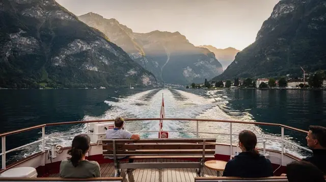
Merligen is the lakeshore village directly below Sigriswil, and it works as either a starting point or a finishing one. It has its own pier on the Lake Thun boat line, a public beach and swimming area, and is the closest jumping-off point for the St. Beatus Caves a short walk or drive along the shore road towards Interlaken.
There’s no cable car or funicular connecting Merligen directly up to the Sigriswil bridge — the two are linked by road and by a marked walking path (roughly 45 minutes to an hour uphill, considerably faster down), or by taking the bus back up. Coming down from the bridge to Merligen for a swim and the boat home is the more comfortable direction if you’re doing both in one day.
Merligen is also a reasonable, quieter base for anyone doing several days on Lake Thun rather than staying in central Interlaken — fewer hotels, lower prices, and a direct boat connection rather than a bus transfer.
The Justistal: a valley most visitors never see
Above Sigriswil, past the last houses, the road climbs into the Justistal, a narrow farming valley closed to most through-traffic and largely unknown outside the region. It’s alpine dairy country in the traditional sense: scattered Berghaus buildings, grazing cattle, and small-scale cheese production that still follows the seasonal rhythm of moving herds up in early summer and back down in September.
There isn’t much to “do” in the Justistal in the conventional sightseeing sense — no ticketed attraction, no viewpoint with a name — and that is more or less the point. It’s a place to drive or hike into for the sake of seeing working alpine farmland rather than a managed tourist site, best combined with a stop at one of the small on-farm cheese sellers if you time it right in summer.
The Käsereiten
The one date worth building a visit around is the Käsereiten, usually the second Saturday of September, when the Justistal’s herds are brought back down from their summer pasture in a procession through Sigriswil — decorated cattle, cowbells, traditional dress, and a market selling the valley’s own alpine cheese alongside food stalls and music. It’s a genuine end-of-season farming event rather than a re-enactment staged for visitors, which also means it draws real crowds from the surrounding villages; arriving early and checking bus timetables in advance is worth the effort, since parking in Sigriswil itself is limited on the day.
Compare this with the more heavily marketed Alpabzug festivals elsewhere in the Bernese Oberland — Sigriswil’s version is smaller and less photographed, which for many visitors is exactly its appeal.
Getting there from Interlaken
| From | Method | Time | Approx. cost (one way) |
|---|---|---|---|
| Interlaken West or Ost | Bus 21 to Sigriswil Dorf | ~25–30 min | CHF 8–10 |
| Interlaken West | Boat to Merligen | ~35 min | CHF 15–18 |
| Merligen | Bus or on foot to Sigriswil (bridge) | 10 min bus / 45–60 min uphill walk | CHF 4 bus |
| Interlaken | Car via Beatenberg road | ~20–25 min | Parking CHF 5–10/day at trailhead |
A Swiss Travel Pass or the local Bödeli hospitality card covers the bus and boat legs; check which zones your pass includes before assuming full coverage on the lake boats specifically.
What a day actually costs
| Item | Typical cost (CHF) |
|---|---|
| Bus, Interlaken to Sigriswil, return | 16–20 |
| Boat, Interlaken to Merligen, one way | 15–18 |
| Lunch at Panorama-Beizli or similar | 20–28 |
| Coffee or drink | 4–6 |
| St. Beatus Caves entry (if added) | 20 |
| Total, bridge and trail only | 40–55 |
| Total, with Merligen and caves added | 75–90 |
The bridge and trail themselves cost nothing beyond transport — this is one of the cheaper full mornings out from Interlaken, and a useful budget contrast to the mountain railways.
Combining it with a boat tour
If you’d rather see Lake Thun from the water first and walk afterwards, or skip the walking altogether, a guided option covers the lake, the caves and a picnic stop in one booking:
a Lake Thun cruise with a St. Beatus Caves stop and picnicFor visitors arriving from further afield, there’s also a day tour that starts in Basel and works its way to the same caves and lake:
a day tour from Basel taking in Thun, the Beatus Caves and a lake cruiseAnd for a more active take on the Sigriswil ridge itself, there’s a guided route to the Rothorn above the village run by a local athlete, aimed at hikers who want more distance and elevation than the bridge loop alone:
a guided hike to the Sigriswil Rothorn with a Swiss triathleteWhere else to go from here
Sigriswil and Merligen sit within easy reach of the rest of the north shore. Oberhofen and Hilterfingen further along the lake have their own castle and gardens for a gentler afternoon; Beatenberg and the Niederhorn extend the ridge walking to a higher, more open summit; and Thun at the lake’s western end is a reasonable base if Interlaken’s hotel prices are the deciding factor.
For anyone building a longer stay around the two lakes rather than the high mountains, see our guide to Lake Thun boat trips and the comparison of Lake Thun versus Lake Brienz for which shore suits which kind of day.
If swimming is part of the plan, both Merligen’s public bathing area and several spots further along the shore are covered in our guide to swimming in Lake Thun and Lake Brienz. For anyone weighing this against the region’s bigger-ticket excursions, our roundup of day trips from Interlaken puts Sigriswil’s cost and time commitment next to the Jungfraujoch, Schilthorn and Lucerne options, and our list of Interlaken viewpoints places the panoramic bridge alongside Harder Kulm and Schynige Platte for anyone choosing just one.
For hikers wanting more after the Two Lakes trail, Best day hikes from Interlaken and Easy flat walks around Interlaken both cover routes at a similar level of exertion, while cycling and e-bike routes around Interlaken include a version of the lakeshore road past Merligen for anyone who’d rather pedal than walk.
If a farmhouse cheese stop is the goal rather than a bridge crossing, cheese dairies of the Bernese Oberland covers the Justistal’s producers in more detail, and our regional events and festivals guide lists the Käsereiten’s confirmed date alongside the area’s other seasonal fixtures. A three-day plan built around the two lakes and their villages, including a Sigriswil half-day, is laid out in Two lakes and villages in three days.
Sigriswil and Merligen: the questions people ask
How long does it take to walk across the Sigriswil panoramic bridge?
About eight to ten minutes at an ordinary pace. It sways gently underfoot, which unsettles some visitors more than the 182m drop below does, but there is a solid mesh floor and high side cables the whole way.
Is the bridge free to visit?
Yes. There is no ticket and no gate. You pay only for getting to Sigriswil and, if you want food or a drink, at the restaurant near the trailhead.
How do I get to Sigriswil from Interlaken without a car?
Take bus 21 from Interlaken West or Interlaken Ost towards Sigriswil Dorf, roughly 25 minutes. There is no direct boat stop in Sigriswil itself; Merligen, on the lake below, has the boat pier.
What is the Two Lakes trail?
A signed hiking route (Zwei-Seen-Weg) along the ridge above Sigriswil that passes the panoramic bridge and, from clear high points, shows both Lake Thun and Lake Brienz at once. Most people walk a two to three hour loop rather than the full multi-day route.
What is the Käsereiten?
An annual cattle procession in the Justistal valley above Sigriswil, usually the second Saturday of September, marking the end of the alpine summer with decorated cows, cheese sale, music and food stalls. It draws a genuine local crowd, not a staged tourist show.
Can I combine Sigriswil with Merligen and the St. Beatus Caves in one day?
Yes, and it is the natural pairing. Walk or bus down to Merligen, take the short connecting bus or a 30 to 40 minute lakeshore walk to St. Beatus Caves, then catch the boat back to Interlaken from either pier.
Does the bridge close in bad weather?
It can. Strong wind (the Föhn especially) and icy conditions lead to temporary closures, the same as any exposed structure at this altitude. Check conditions before making a special trip in shoulder-season weather.
Is Sigriswil suitable for a half-day trip with children?
Generally yes for children old enough to hold a handrail confidently and walk 30 to 45 minutes on gravel paths. The bridge itself has full-height side netting, which reassures most parents more than the height itself worries them.