Easy flat walks around Interlaken
What are the best flat walks around Interlaken?
The four reliable ones are along the River Aare from Interlaken to Unterseen, the Lake Brienz shore path to Bönigen, the Lombach dike near Ringgenberg, and the short lakeshore loop at Faulensee on Lake Thun. All are paved or firm gravel, under 300 m of vertical change, and manageable with a pushchair or wheelchair with assistance on a couple of cobbled stretches.
Not every day needs a mountain
Most of what gets written about Interlaken assumes you’re heading up: the Jungfraujoch, the Schilthorn, a day on the best hikes from Interlaken list with 800 m of climbing before lunch. That’s fine when the weather cooperates, your knees are willing, and nobody in the group is under four years old or pushing a stroller. On the days when none of that applies — a rainy morning, a recovery day after Grindelwald First, a grandparent along for the trip — the town itself sits in a genuinely flat river valley between two lakes, and four short walks cover it without a single serious incline.
None of these are hikes in the alpine sense. There’s no summit, no view that needs earning, and no mountain railway ticket to buy. What they offer instead is time outdoors that costs nothing, works with a pushchair or a wheelchair on most sections, and takes 30 minutes to two hours depending on how far you go. Two follow water you’re already looking at from your hotel window — the Aare river and Lake Brienz — and two are less obvious: a flood dike at the mouth of a small river, and a lakeside village most visitors only see through a train window.
The four walks at a glance
| Walk | Distance | Time | Surface | Elevation change | Pushchair-friendly |
|---|---|---|---|---|---|
| Aare: Interlaken to Unterseen (loop) | 3.5–4 km | 45–60 min | Paved, short cobbled stretch | Under 5 m | Yes, mostly |
| Lake Brienz shore to Bönigen | 2 km one way | 25–30 min | Paved and gravel | Flat | Yes |
| Lombach dike, near Ringgenberg | 2.5–3 km | 35–45 min | Gravel, can be muddy | Flat | With care |
| Faulensee lakeshore loop | 1.2–1.5 km | 20–25 min | Paved | Flat | Yes |
None of these require a reservation, a ticket, or specific footwear beyond ordinary trainers. Trekking poles are unnecessary. What you do need, especially for the Lombach dike, is a look at the weather in the two days before you go — heavy rain upstream in the Habkern valley raises the water table under that path faster than it does anywhere else on this list.
Choosing the right walk for your day
If you only have time for one, start with the Aare: it needs no planning, no timetable and no boat, and it gives you a feel for the town that helps when you later plan how many days to spend in Interlaken. The Bönigen shore suits a slow morning with a picnic, the Lombach dike suits anyone who likes quiet and birds more than cafés, and Faulensee suits a day when you want a change of scene without a long journey.
Think about who is walking, too. A group with a toddler will want benches and a playground, which points to Bönigen. A grandparent who tires quickly will like the Aare, where a bench is never far away and a café is always close. Someone who has just come off a hard day on the Eiger Trail or a long ridge walk will probably prefer the lakeshore, where the pace is entirely yours.
Walk 1: the Aare, from Interlaken to Unterseen
This is the walk to do on your first evening, because it explains the town’s geography better than any map. The River Aare flows out of Lake Brienz near Interlaken Ost, cuts through the middle of Interlaken, and empties into Lake Thun close to Interlaken West. Start at the Ost end, near the Aare outflow, and follow the paved riverside path west along the south bank, past the edge of the Höhematte meadow with the Jungfrau framed behind it on a clear day, and on towards the West station area where the river widens into Lake Thun.
Rather than stopping at the West station, cross one of the footbridges to the north bank and walk back east into Unterseen, the old town that predates Interlaken itself — it was founded in 1279, while Interlaken grew up later around the monastery on the other bank. The Stadtkirche and the wooden-shuttered houses on Marktgasse sit on genuine cobblestones, the only rough patch on the entire route, maybe 150 m of it. A pushchair rolls over it without drama; a wheelchair user coming through will notice the vibration.
From Unterseen, the path continues along the river’s north bank back towards the Ost end, closing the loop. Total distance for the full circuit is around 3.5 to 4 km, walkable in under an hour without stopping, longer if you sit at one of the benches along the Aare — the water here runs the pale turquoise-grey of glacial silt, cold enough that nobody swims in this stretch even in August, unlike the lakes at either end.
Combine it with a coffee stop in Unterseen’s old town, or extend it by continuing along Lake Thun’s shore towards Neuhaus if you have another hour. For a version of the town on wheels rather than on foot, the Discover Interlaken lakes, ruins and views e-bike tour covers a wider loop including both lakeshores in a couple of hours, useful if flat but longer distances suit you better than flat but short ones.
The Aare walk also works well as an evening stroll after dinner, when the light softens on the river and the meadow empties out. If you are still deciding where to eat, the Interlaken restaurant guide is a useful companion, and the free things to do in Interlaken page lists other no-cost ways to fill a spare hour.
Walk 2: the Lake Brienz shore to Bönigen
From Interlaken Ost, the lakeside promenade runs east along Lake Brienz to the village of Bönigen, about 2 km, all of it flat and mostly paved with a gravel stretch nearer the village. This is quieter than the Aare walk — Bönigen doesn’t see the same tour-bus traffic as central Interlaken, and the path along the water gets used more by locals cycling to work than by visitors.
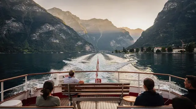
The lake itself is the reason to come: Lake Brienz runs a deeper, more saturated turquoise than Lake Thun, fed by glacial meltwater rather than the mixed sources feeding Thun, and on a still day the colour is genuinely striking rather than a marketing claim. Bönigen has a public lido, Strandbad Bönigen, open through the summer season with a small entry fee, and a working boat pier served by the BLS fleet on the Lake Brienz boat route. Walking there and returning by boat — or the reverse — turns a there-and-back walk into a loop with no repeated ground, and the boat ride adds another 15 minutes of the same view from the water.
Benches are spaced generously along the whole route, and there’s a small playground near the Bönigen end if you’re travelling with children who need a break from moving in a straight line. Toilets exist at the lido in season; outside the summer months, plan around Interlaken Ost’s station facilities instead.
If the weather turns warm, the shore is also a natural place to think about a swim; the guide to swimming in Lake Thun and Lake Brienz explains how the lidos and open shore access differ. Walkers who want a longer stretch of the same water can read about the Giessbach falls and shore path further along the lake.
Walk 3: the Lombach dike
Less obvious, and correspondingly less busy. The Lombach is a small river that drains the Habkern valley above Interlaken and reaches Lake Brienz at a delta between Bönigen and Ringgenberg, where decades of sediment have built a flat, marshy plain now managed as a flood-control zone. A gravel dike path runs along the top of the embankment, giving a straight, level walk of roughly 2.5 to 3 km with the lake on one side and reed beds and wet meadow on the other.
This is the best of the four walks for birdwatching — herons stand in the shallows regularly, and the reeds hold nesting warblers in late spring. It’s also the one walk on this list without much infrastructure: no benches to speak of, no lido, no café at either end, and only partial signposting where the dike meets the road at Ringgenberg and near Bönigen. The path itself is unambiguous, following the river mouth in a straight line, so getting lost isn’t a real risk, but don’t expect the level of way-marking found on the marked mountain trails.
The one condition worth checking before you go: after sustained rain or during spring snowmelt, the dike path can flood or turn to standing mud in low spots, since it exists specifically to manage water that the Lombach can’t otherwise contain. A dry forecast for the preceding two or three days is a reasonable proxy for whether the path will be walkable.
Reach either end from Interlaken Ost by the regional train towards Brienz, getting off one stop early at Ringgenberg-Goldswil, or walk out from Bönigen after finishing Walk 2 and treat the two as one longer outing.
Walk 4: the Faulensee lakeshore loop
Faulensee is a small settlement directly on the shore of Lake Thun, between Spiez and Krattigen, reachable from Interlaken West by the BLS line towards Spiez in about 20 minutes — check that your specific train calls at the Faulensee halt, since not every service on that line stops there. In summer, the Lake Thun boat also calls at Faulensee, which makes a walk-one-way, boat-back combination straightforward.
The walk itself is short: a paved lakeside path of maybe 1.2 to 1.5 km looping through the village and along its waterfront, entirely flat. What makes the trip worthwhile is the view rather than the distance — across the water sit the Niesen’s pyramid outline and the Stockhorn ridge, a different angle on the Bernese Oberland than anything visible from Interlaken itself. Faulensee has its own public lido, Strandbad Faulensee, smaller and quieter than the ones nearer Interlaken, with the same modest entry fee in season.
This is the walk to pick when you want to see a genuinely different piece of the region without committing to a half-day out. Pair it with a stop in Spiez to see the castle above the harbour and you’ve turned 20 minutes of flat walking into a half-day trip that still involves no climbing at all.
Bring binoculars if you have them, and go early or late in the day, when the shallows are quietest and the birds are least disturbed. Keep to the path and keep dogs close, since the reed beds are where the wildlife lives. Because there is no café at either end, carry whatever you want to eat or drink; the shops back in Bönigen or at Interlaken Ost are the nearest fallback.
Combining the walks with the rest of the region
None of these four require dedicating a full day, which is their real advantage over the mountain excursions that structure most Interlaken itineraries. A rainy morning covers the Aare loop and a coffee in Unterseen; a free afternoon between a morning at Harder Kulm and dinner covers Bönigen and back by boat.
If flat but longer distances appeal more than flat but short ones, the e-bike routes along both lakeshores cover similar ground at a faster pace. The Interlaken: Explore Iseltwald, Giessbach and views e-bike tour follows the Lake Brienz shore well past Bönigen towards Iseltwald, useful if the 2 km walk to Bönigen leaves you wanting more of the same view rather than less.
For those in the group who do want elevation on the same day someone else is doing a flat walk, the Interlaken: hike to an alpine lake and a cozy mountain hut tour runs as a guided alternative that starts from town and climbs properly, letting a group split for a few hours and reconvene. And for a day trip built around a different kind of flat scenery entirely, the private day trip from Interlaken to the Lauterbrunnen waterfalls covers the valley floor beneath the Staubbachfall without requiring anyone to climb to a viewpoint.
Getting between the starting points is easy without a car. The trains, buses and boats around Interlaken guide explains how the local network fits together, and the Swiss Travel Pass guide is worth a look if you plan to use the boats on several days. For families building a full week around short outings like these, Interlaken with kids and the two lakes and villages itinerary pull the same ideas into a plan. Travellers who need step-free access can also check the accessibility guide for the Jungfrau region.
What to bring, and what not to expect
Ordinary trainers cover all four walks; nothing here needs boots or poles. A light rain jacket is worth carrying regardless of forecast, since Interlaken’s valley position between two lakes generates its own microclimate and showers arrive with less warning than the wider regional forecast suggests. Water bottles are useful on the Faulensee and Lombach walks, where there’s no café at hand; the Aare and Bönigen routes both pass shops and kiosks along the way.
What none of these walks offer is drama. There’s no waterfall on any of the four, no viewpoint that needs a photograph, and the total elevation gain across all four combined is less than one flight of stairs in a Jungfraujoch queue. That’s the point. On a day when the cable cars are closed for wind, or a knee needs a rest day, or a toddler has opinions about being carried up anything, these are the four places in the Interlaken area where the ground simply stays level for as long as you want to keep walking.
Lake cruises & boat tours on GetYourGuide
Verified deep-linked GetYourGuide tours. Book through these links and we earn a small commission at no cost to you.
GetYourGuide does not provide a product photo for this activity — the image shows the meeting point, photographed by us.